“The Ramparts of God” Part of the joy in being retired is freedom of time and as the temperature began to approach the 100’s in Billings I decided to leave town and spend three weeks exploring the Rocky Mountains of northwestern Montana. The plan is to head northwest from Billings to Glacier National Park, cross over into the Flathead Valley, explore the forests of the northwest corner of Montana, then turn east and tour central Montana before returning south to Billings. Augie the doggie and I packed up and hit the road. Come along!
St. Mary, MT to Many Glacier Hotel and back (Hwy 89 north to Babb, west on Hwy 3 to the hotel)
Glacier National Park contains nearly one million acres (4,000 square kilometers) of virtually pristine natural environment and, together with the adjacent Bob Marshall Wilderness and Rocky Mountain Front to the south, protects over 1,600 square miles of stunning natural beauty . This is not a park designed to be explored by auto, and, in fact, only three paved roads enter the park, two of those stop at the head of glacial valleys and only one, the famed “Going to the Sun” highway, crosses the park from east to west. Best explored on foot, Glacier is one of the premier hiking destinations in North America. The area was carved by massive glaciers which, upon retreating, left deep U-shaped valleys running east or west away from the “Spine of the World”, as native Americans referred to the mountains. As the glaciers retreated they left small moraines, or ridges, blocking the valleys, and a series of lakes were formed. In 1885 George Grinnell came to the area on a hunting expedition and began the movement towards the creation of a national park. His efforts were bolstered by James J. Hill, who brought the Great Northern Railway to the area in 1891, touching the current park boundaries at East Glacier and running south along the southern boundary of the park across the Marias Pass and on to Seattle, Washington. The park was officially established in 1910. After the creation of the park, a subsidiary of the Great Northern Railroad, led by Louis Hill (son of founder James J. Hill) established a series of small chalets throughout the park only accessible by horse or foot, as well as a couple of major hotels, all designed to mimic structures from Switzerland, as Hill billed Glacier as “America’s Switzerland.” On the eastern side of the park there are three major glacial valleys which can be accessed by auto: Many Glacier to the north, St. Mary in the middle, and Two Medicine in the south. On the west only the Lake McDonald Valley (the western section of the famed Going to the Sun Highway) has a paved road and is easily accessible by vehicle. The rest of the west, commonly known as the North Fork area, can be entered on a few rugged dirt roads suitable for four-wheel drive vehicles (which the Lunch Box is not!)
Many Glacier is the site of one of Lewis Hill’s grand hotels, the Many Glacier Lodge. It sits at the head of a magnificent valley drained by Swiftcurrent Creek at the end of a 12 mile long paved road that runs west off of Hwy 89 at the town of Babb. There is nothing else in this area of the United States that draws people and traffic is relatively light as I-15 80 miles to the east is the major route to Canada. I was here on 4th of July weekend and the campgrounds were already full, so there was even less traffic. A good thing because the roads are not particularly wide! Leaving our home base in St Mary we head north on Hwy 89 to Babb before turning left and heading west up the valley to Many Glacier at the end of the road. The range of mountains to the left lie between the Many Glacier Valley and the St Mary Valley. This is the same range that is in the background of the Lunch Box in the campground picture in the last chapter.

The road is in pretty bad condition, but at least there is no “official” road construction! Soon after turning east, we come up on Lake Sherburne, which is nearly six miles long, filling the valley floor from east to west. Lake Shelburne is not a natural lake but was formed by a dam constructed between 1914 and 1921 as part of a flood control and irrigation project along the Milk River in northern Montana. These pictures document the drive up the valley, with the lake to the left of the road (south) and mountains rising to the north.


At the end of the lake the road continues to climb up the valley and it becomes increasingly clear that the valley is “Y-shaped”. Soon the turn-off to Many Glacier Hotel appears and we pull into the last RV parking space in the entire parking lot. Wa-hoo! The parking lot sits on a hill above the actual hotel, which is at lakeside on Swiftcurrent Lake, and a brief hike takes me to a view point where I get a 360 degree view of the end of the valley. Standing in one spot and just turning around to my right, here are the views to the southeast, southwest, west, northwest, and northeast.


 The buildings visible comprise the Many Glacier Hotel, perched on the eastern shore of Swiftcurrent Lake with incomparable views to the west. The Great Northern delivered guests to the train depot in East Glacier and then they travelled at first via horse drawn carriages, then by chaufferred buses, north to Babb before climbing west up the Many Glacier Valley. Glacier National Park was touted in all the major publications of the day by the Glacier Hotel Company, which ran the tourist operations in the park as a subsidiary of the Great Northern. Here, preserved under glass, is a copy of an ad from the April 29, 1916, issue of the Saturday Evening Post (that might date most of us, who remembers this magazine, I sure do!) During 1914-1915 (including the winter months) over 400 craftsman built Louis Hill’s vision of a Swiss hotel on the shore of Swiftcurrent Lake.
The hotel sprawls along the lakeshore, centered on the portico which greets guests alighting from vehicles under cover from the weather and then greeting them with the magnificent three story atrium reception area, complete with skylights.

The view to the south of the atrium, then the view to the north.


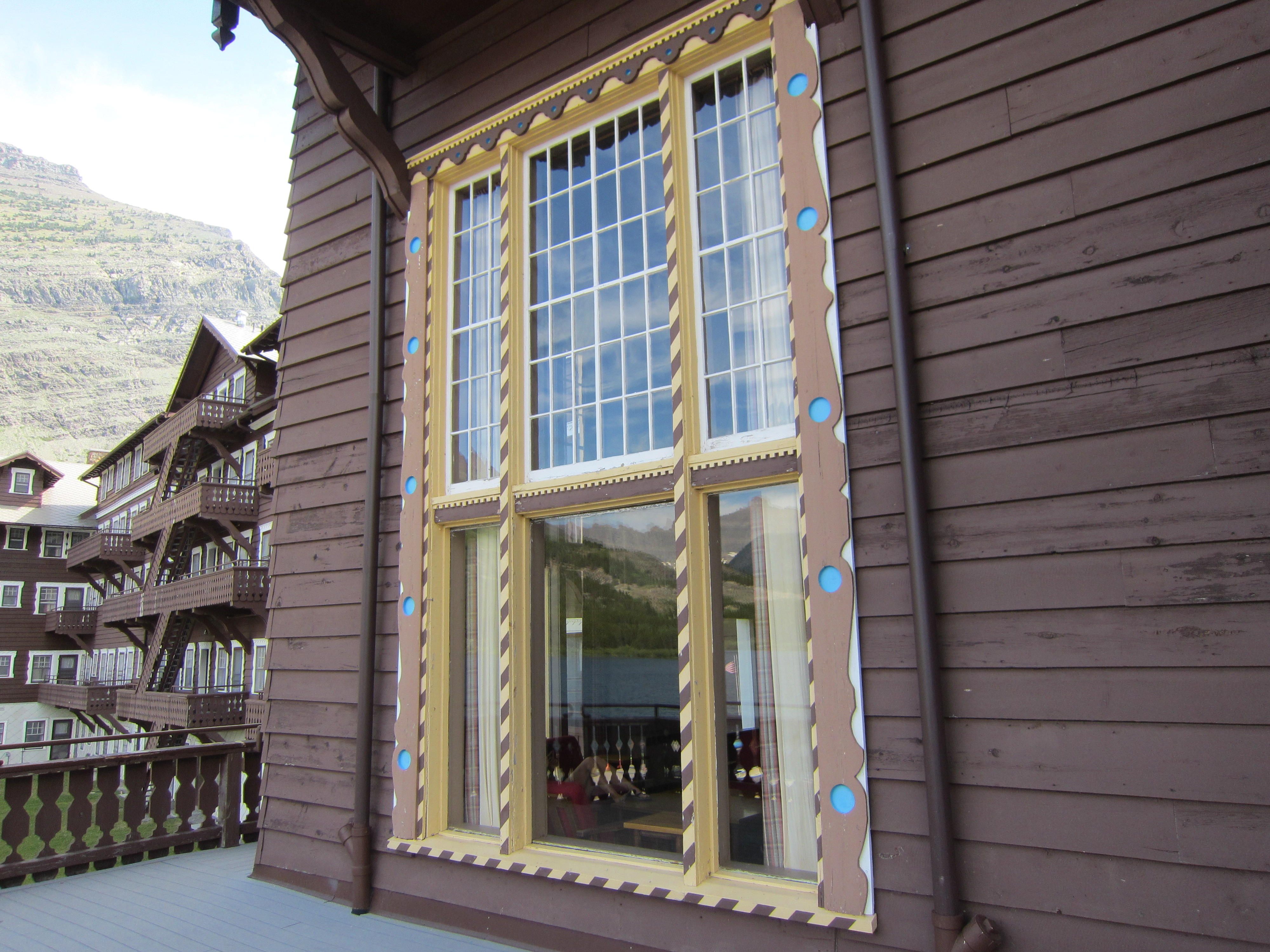
Rising above the stone arches of the lakeshore level, balconies line the façade of the hotel facing west with a long deck stretching the length of the building, all built in the style of a Swiss chalet with carved details around the large windows of the public rooms.


Sitting on an Adirondack chair on the deck, I take in the views across the lake.


The road ends at the hotel and as I leave the lakeshore I pause to look back at the magnificent setting where Swiftcurrent Creek leaves Lake McDermott just east of the hotel and begins its’ plunge down the valley. The hotel is just beyond the line of trees in the center of the picture.

Driving back down the valley the views open up on both sides of Lake Sherburne.


Next up: St Mary Valley and the Going to the Sun Highway
Post a Comment