The Silver Valley
As the Coeur D’Alene River valley continues its’ climb through the mountains it narrows mile by mile. The landscape assumes a “sameness” that is puzzling to the eye. We are now in the middle of one of the largest reclamation sites in the Northwest. When I drove through in 1972 headed to Linfield College within the 6 mile drop from the top of Lookout Pass to the valley floor east of Wallace Idaho the landscape changed from lush mountain forests to a stark, naked environment. Gold was first discovered in 1860 but the true source of wealth came from one of the world’s greatest concentration of silver (thus the name “Silver Valley”). Between 1884 and 2011 1.2 BILLION ounces of silver was mined in the valley, with production in 2011 alone worth $250 million dollars. However, the land paid a huge price during the extraction of the wealth.
While mining practices evolved over the years, the process used to refine the raw mineral into silver produced many chemicals and byproducts that destroyed the environment. In 1972 the mountainsides of the upper valley between Wallace and Kellogg were bare with minimal vegetation because of the air and land pollution. The valley floor was a series of gravel hills, tailings from the mines that leached pollutants into the river. As noted in the last chapter, even back in 1917 the pollution was so intense that the flood of 1917 pushed enough of the poison more than 20 miles downstream and destroyed the farmlands of the Cataldo Mission, rendering them unusable for farming. An intensive restoration effort has taken place and now the hillsides have been reforested and the valley floor reclaimed, though the result is a rather “sameness” to the eye. This picture was taken at a wayside just outside of Kellogg looking up to the mountains south of town that used to be bare. In the forefront is one of the mining cars that used to run deep inside these mountains, moving miners and ore to the surface.

Many died in the pursuit of wealth and not just in older times. In 1972 the Sunshine Mine experienced one of the worst mining disasters in US mining history. Fire ravaged the mine deep inside the earth and 91 miners lost their life. The environment immediately around the mines was not pleasant to live in and the managers and owners did not live nearby, thus there are no “cute” restored buildings in Kellogg. This was rough and tumble mining. Owners lived in Spokane or farther, but the “capital” of the Silver Valley was the town of Wallace at the eastern end of the valley at the foot of Lookout Pass. The entire town is on the National Register of Historic Buildings and has retained much of its’ original character. You may have seen Wallace and not have known it. About 20 years ago a “disaster” movie entitled “Dante’s Peak” was filmed in Wallace (about a town being destroyed by a volcano – think Pompeii 2000 years later with Pierce Brosnan (one of the James Bond actors) in the lead.

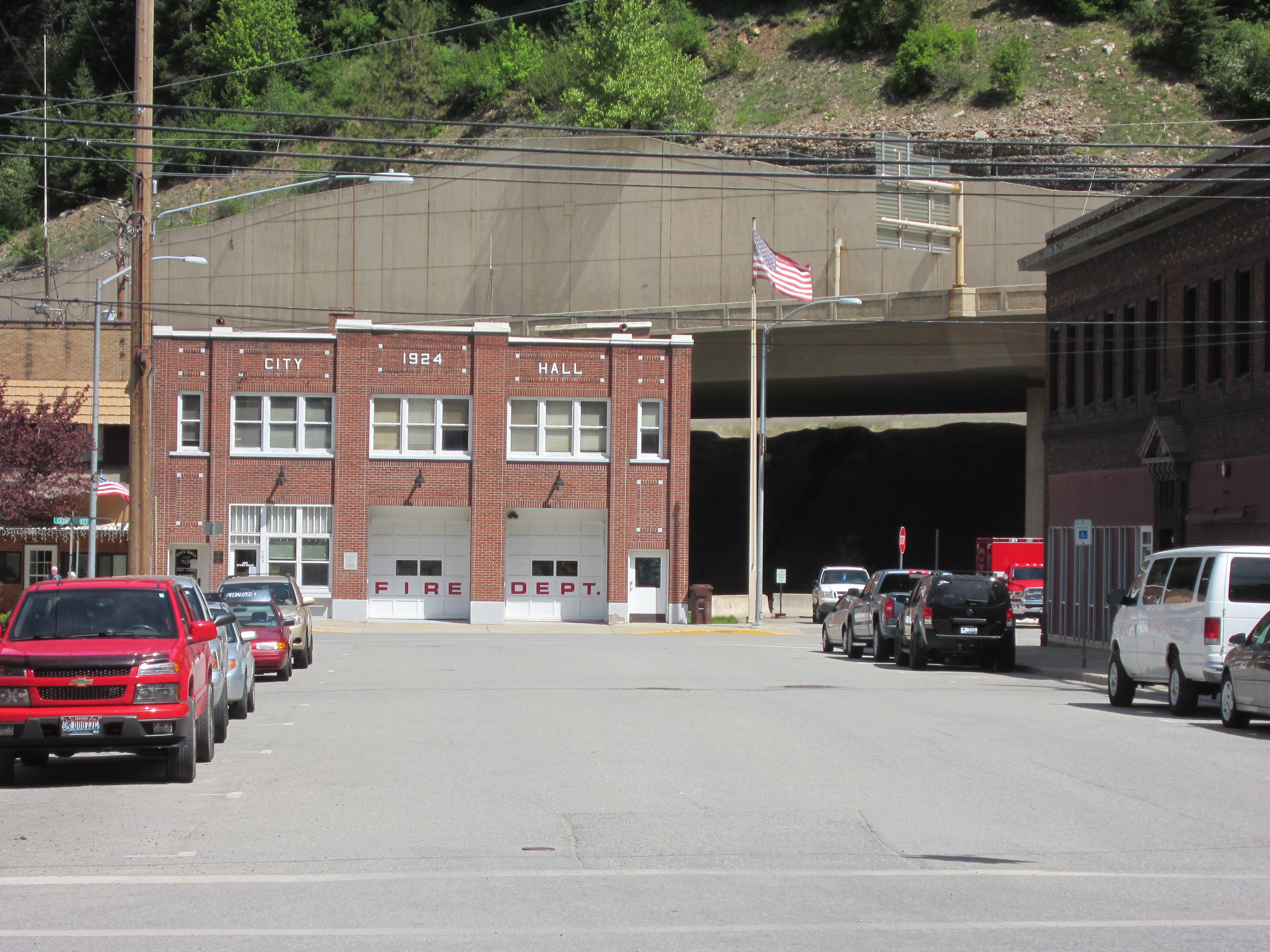
The valley becomes so narrow at the eastern end of Wallace that when I-90 was built the freeway was elevated for nearly a mile to avoid wiping out the town. As you can see in some of the pictures, historic buildings huddle under the freeway. There is a park and tourist information center at the west end of town so Augie and I pull off for lunch and a potty break. This is getting close to the real ‘Merica, and even the dog signs reflect a more direct culture…


The buildings in Wallace reflect its’ historic role in the valley. This is where the miners went for entertainment. References to brothels, bordellos, bars, etc., are reflected in the names of various buildings and businesses along Main Street. Tourism is an important part of the economy and Wallace is making a valiant effort to grab its’ piece of the pie! Note that in the background of the town pictures you can see the elevated lanes of I-90.


 At the east end of town the freeway takes up the entire valley floor.

Just east of Wallace the crossing of the Rocky Mountains to the Great Plains begins in earnest. Unlike the Cascades familiar to most of my readers; the Rockies are not a single chain of mountains running north to south. Instead think of a “bunched up blanket” with a series of ridges running north to south. I-90 runs in a south easterly fashion through Montana in a large semi-circle as it stretches from Missoula down to Billings and then again up to North Dakota. Outside of Wallace the highway immediately climbs up to Lookout Pass and Montana and then in the next 500 miles crosses to more major passes (Homestead outside of Butte and Bridger outside of Bozeman) before hitting the Yellowstone River, the pathway into the Great Plains.
This trip I’m wandering off I-90 at Missoula and heading over the mountains to Helena, the state capital, for a little central Montana tourism.
See you there.
Post a Comment