
For more than 2,000 years the Anasazi flourished across the upper Rio Grande River drainage and southern Colorado Plateau west of the Rocky Mountains, an arid land carved by the elements into mesas, canyons, grasslands and deserts. The heart of their civilization spanned southeastern Utah, southwestern Colorado, northeastern Arizona and northwestern New Mexico, today more commonly known as the Four Corners area as the states of Utah, Colorado, New Mexico and Arizona all meet at the only “four corner” boundary in the United States. The civilization suddenly vanished around 1300 AD, abandoning their cities and towns to the vagaries of time. Fortunately for us, many of those communities were built in cliff dwellings, tucked into canyon walls and protected from the weather. This fall we’re going to explore the “Land of the Anasazi”.

The journey begins by heading southwest from Billings through the heart of central Wyoming to northern Colorado.

When most people think of Wyoming the peaks of the Grand Tetons pierce the sky, the eerie Devils Tower comes back to us old folks from the movie “Close Encounters of the Third Kind”,or cattle roam plains of rippling grass. The reality is far different. There’s a reason that Wyoming is the state with the smallest population in the United States (a little over half a million people) despite being the ninth largest in land area, and it’s all about the land. Outside of the scenic mountain areas and far eastern plains, Wyoming is a vast, unforgiving semi-arid rugged land with extreme weather, both winter and summer, little water, and poor soil. About 100 miles south of Billings we enter the area commonly known as the Big Horn Basin, named after the Big Horn River which flows northeast through the center of Wyoming until it enters the Yellowstone River about 60 miles north east of Billings, Montana.
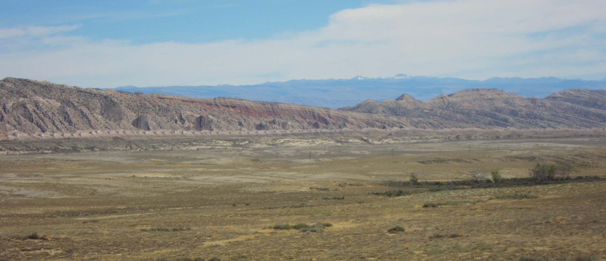
Shortly after crossing the state line, the Big Horn Basin stretches to the southeast, bordered by the Pryor Mountains. Beige is the predominant color. A rare sliver of green runs along the east side of the basin. The Big Horn River runs along the base of the mountains, a narrow green corridor through the stark landscape. For most of its journey the Big Horn is in a canyon of varying depths so, while the river is not visible in this picture, it runs across the view hidden below the hills.

In one of the more shameful moments in US History, this desolate and remote land was chosen in 1942 as one of the sites that housed American citizens of Japanese ancestry in forced confinement during World War II.
“A Day Which Will Live In Infamy…”
This famous quote from President Franklin D. Roosevelt’s speech in response to the Japanese attack on Pearl Harbor on December 7, 1941 leads to our first experience on this trip. As I weave together this chapter of the Lunch Box Journal, I remind myself how easy it is to judge from the perspective of 80 years later…
The surprise attack by the Japanese created a wave of hysteria on the US mainland, especially along the West Coast where a sizable population of Japanese-Americans were residing in Washington, Oregon and California, many of them second and third generation US citizens who were law-abiding and productive members of their community. However, the fear of a secret army of Japanese sympathizers lead to the issuing of Executive Order 9066, which required the immediate and forcible removal of all west coast US citizens of Japanese descent to one of 10 “relocation camps” located in the interior of the country, all on the eastern side of the Cascade/Sierra Nevada Mountains. The closest to Oregon was actually in northern California at Tule Lake, a short distance south of Klamath Falls, and another was at Heart Mountain, about 15 miles east of Cody, Wyoming.

Posters like that above were soon displayed throughout the West Coast. Leaving everything behind and losing all property, individuals were allowed to carry one suitcase of belongings. All else was lost. By August of 1942 more than 120,000 American citizens of Japanese descent were incarcerated in one of the ten relocation camps. Heart Mountain Relocation Camp was built on a high plateau desert in the Big Horn Basin between Cody and Powell along the Shoshone River. There were two levels to the camp. The lower level was along the Shoshone River Valley next to the railroad tracks. During the construction of the camp a canal was also built to bring water to the area, both for personal and agricultural use. The area along the railroad tracks became farmland as the camp raised most of its’ own food. The residential and administrative areas of the camp were built on a plateau northwest of the farms above a gentle ridge in the shadow of Heart Mountain. The camp received its first residents on August 11, 1942.
What they saw upon arrival was beyond belief. Overnight the third largest city in Wyoming had been built of wood and tar paper and soon would house over 10,000 people behind barb-wire and guard towers. The excellent visitor center/museum is built as a replica of three of the barracks that housed residents. When completed, the camp held 468 of these barracks.

The camp was organized into 30 “blocks” separated by a dirt street grid. 20 of these blocks were set aside for residential barracks in groups of 24. Other blocks were reserved for a hospital complex, administration building and two large play areas. Initially the barracks were not insulated and the tar paper/wood was a poor defense against the extreme weather of northern Wyoming. However, in early 1943 insulated panels similar to dry wall arrived and conditions improved slightly. Each barrack was divided into “apartments” which were simply rooms of various sizes designed to hold singles or families that contained cots, a stove for heat and a single light hanging from the ceiling. Communal toilets, shower rooms and two mess halls were provided for each block. This not-so-very good picture from the brochure gives you the outline of the camp. Eventually the camp had its own water system, hospital, post office, court system, fire department, schools and even a miniature zoo. This map of the camp is from the center brochure.

Just behind the visitor’s center is a reconstruction of one of the nine guard towers (brown dots on the map) that guarded the complex. Etched against the sky above the plateau is the chimney from the hospital heating plant. A barbwire fence circled the entire town.

As the road going up to the memorial reaches the crest of a small ridge the broad plateau that served as the town opens up with Heart Mountain looming in the distance. This flat land is now farmed and there is no remnant of the town that once housed over 10,000 people except for the remains of the hospital complex just out of this picture to the right.

There are three buildings that remain standing as part of a hospital complex that once numbered 17 buildings. Like most of the business and services provided in the camp, the hospital was staffed by trained Japanese-American medical doctors and personnel who were residents of the camp. Two of the original hospital wards still stand while nearby the hospital heating plant huddles under a tall smoke stack.


One of the main problems in the camp was keeping everyone busy. Most of the men worked in various capacities but efforts were made to provide recreational outlets for all. There were two elementary schools and Heart Mountain High School, which graduated nearly 800 students during the three years of its’ existence. The high school fielded athletic teams that were given special dispensation to be able to compete with the neighboring high schools in the Wyoming Athletic Association. One of the more challenging academic problems was how to teach the tenets of democracy in the United States to high school students who could look out windows at the barbwire fences and guard posts that confined them in what seemed to be a clear violation of their constitutional rights. Two movie theatres, the Dawn and the Pagoda, were set up in large recreation halls and showed films on weekends. Boy Scout, Girls Scout, and Campfire Girl troops were established and the children allowed to intermingle with troops from neighboring Cody and Powell. At one of these gatherings a lasting friendship was formed between a boy from Cody, Alan Simpson, and a boy in the camp who was from San Jose, California, Norman Mineta. Alan Simpson later became one of the more powerful Republicans in the US Senate for nearly 20 years in Congress during the 1980’s and 1990’s, while Norman Mineta served as Secretary of Transportation under President Bush from 2000-2006.
In one of the more ironic actions on the part of the US government during WWII, the government decided to draft eligible men of Japanese descent from the relocation camps into the US Army. The largest protest of this decision occurred at Heart Mountain. While over 800 men and women from Heart Mountain did distinguish themselves in service in the Armed Forces during the war, 85 protestors refused the draft order. This lead to the largest mass trial in Wyoming history and 63 men were tried, convicted and sent to federal penitentiaries for 3 year terms. A memorial to those who fought stands at the edge of the ridge overlooking the railroad tracks and river valley below.

In the 1940’s several court cases worked their way through the system as the constitutionality of the Relocation Act was debated. The first two lost, but in 1944 the Supreme Court ruled that the plaintiff was “entitled to an unconditionally release by the War Relocation Authority.” This, combined with the winding down of the war, lead to the closing of the relocation camps. Heart Mountain officially closed on November 10, 1945. Internees were given a train ticket and $25 to begin their new lives after the camp, most with nowhere to go and little other resources to rely on since all else was lost when their detainment began. After that sobering reminder of US history, our path continues south through Wyoming to Thermopolis, WY, home to bubbling hot springs and stunning dinosaurs.
Thermopolis, WY
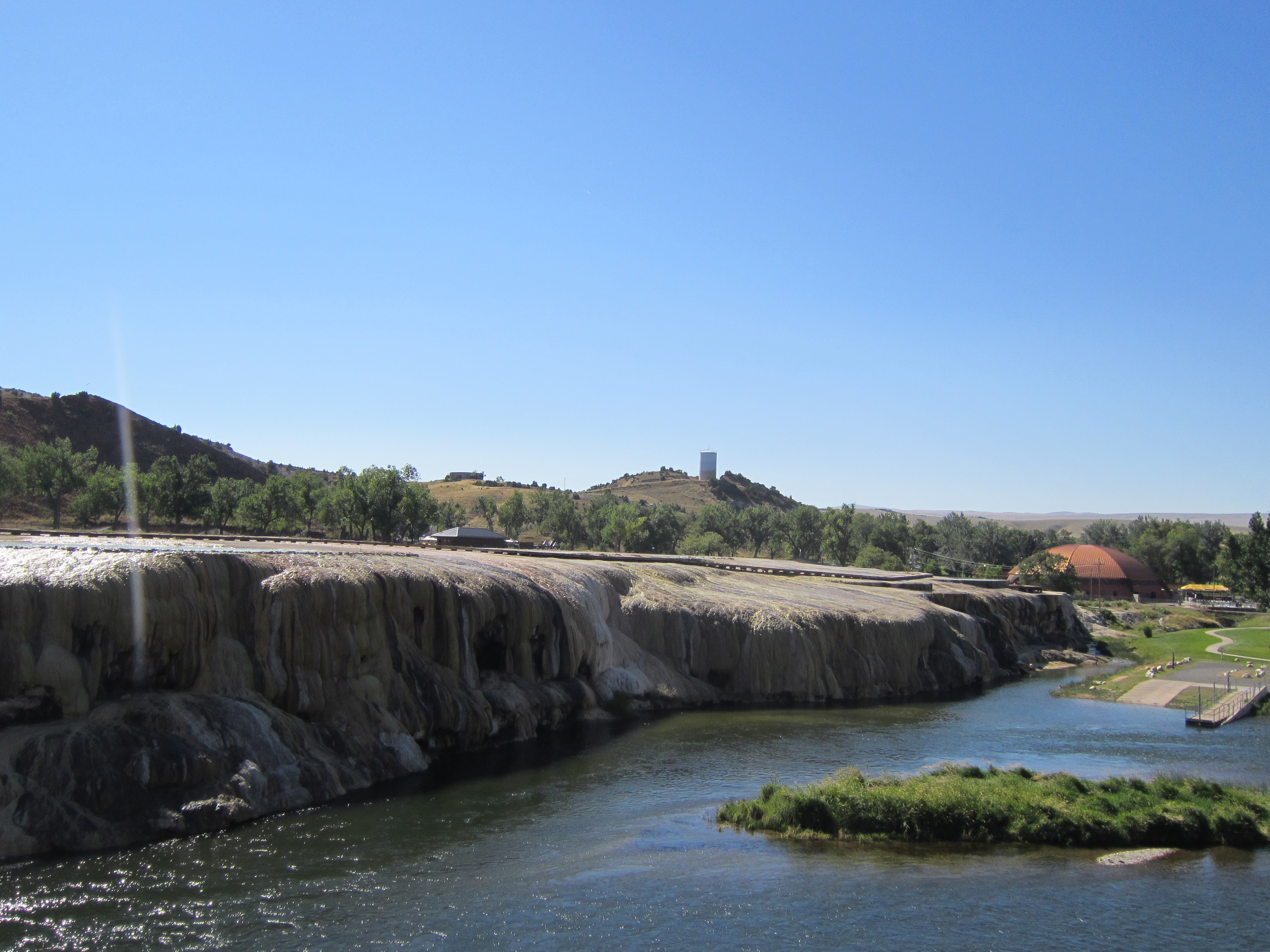
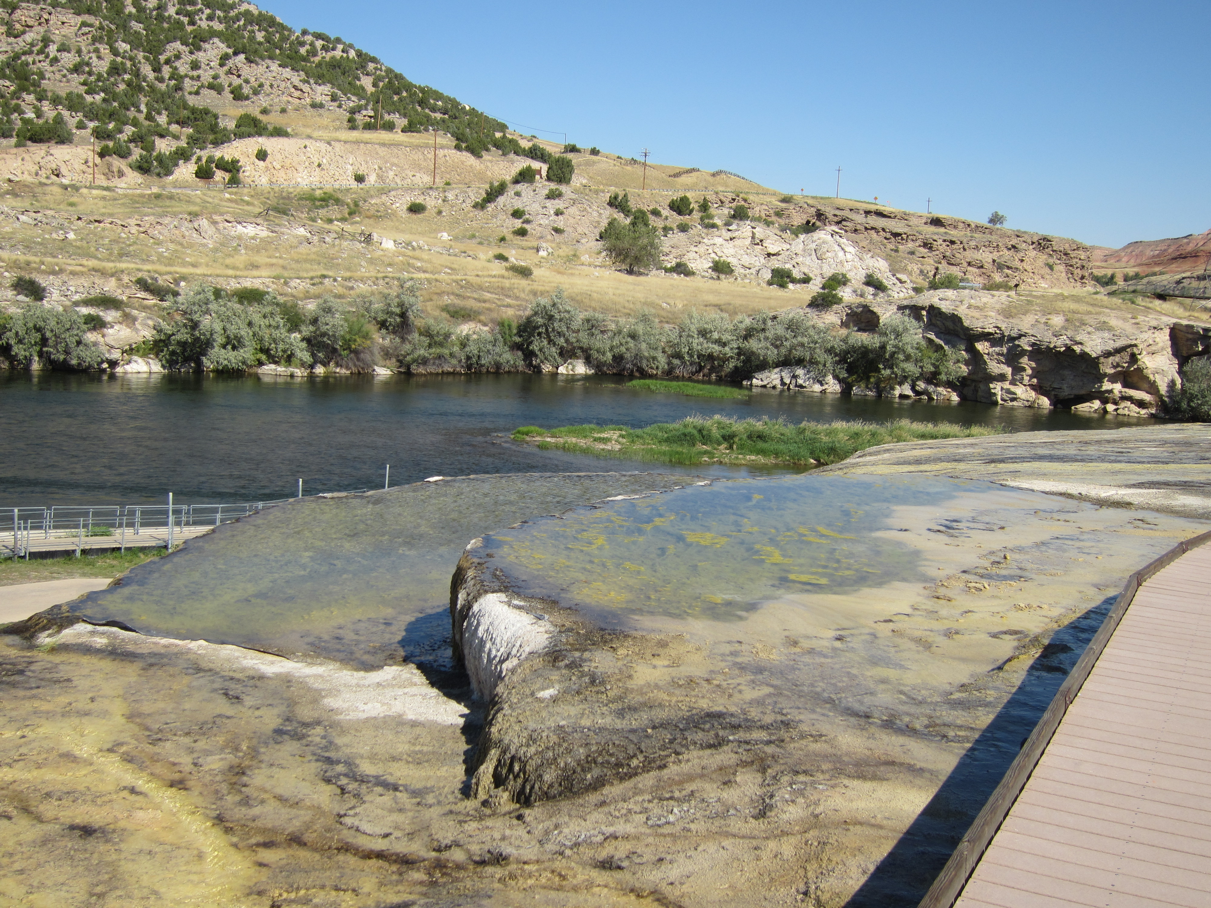
Thermopolis (from the Greek words for “hot” and “city”) was given its’ name because of a large hot spring located above the east bank of the Big Horn River. The “Big Spring” is the largest hot spring in the world, giving forth over 18,600,000 gallons of water every 24 hours at a temperature of 135 degrees with the main pool is approximately 35 feet in diameter. The water flows over terraces formed from various minerals and then cascades down into the Big Horn River (it looks like a small version of the Mammoth Hot Springs area of Yellowstone Park). Originally situated on the Wind River Indian Reservation, the land around the springs was acquired by the federal government in 1896 via treaty. A key part of the treaty required that a portion of the water and access to it remain free to the people. The impact remains visible today as there is no entrance fee to the state park (the only one in Wyoming that is free to the public) and there is an official State of Wyoming Bath House that is free to the public, It houses a 20′ by 20′ pool fed by the hot spring that is accessible free of charge. Of course, the state bath house pales in comparison to the two private business that flank it around the spring. Both of them have large indoor and outdoor pools, water slides, etc. The entire complex is just across the Big Horn River from downtown Thermopolis.
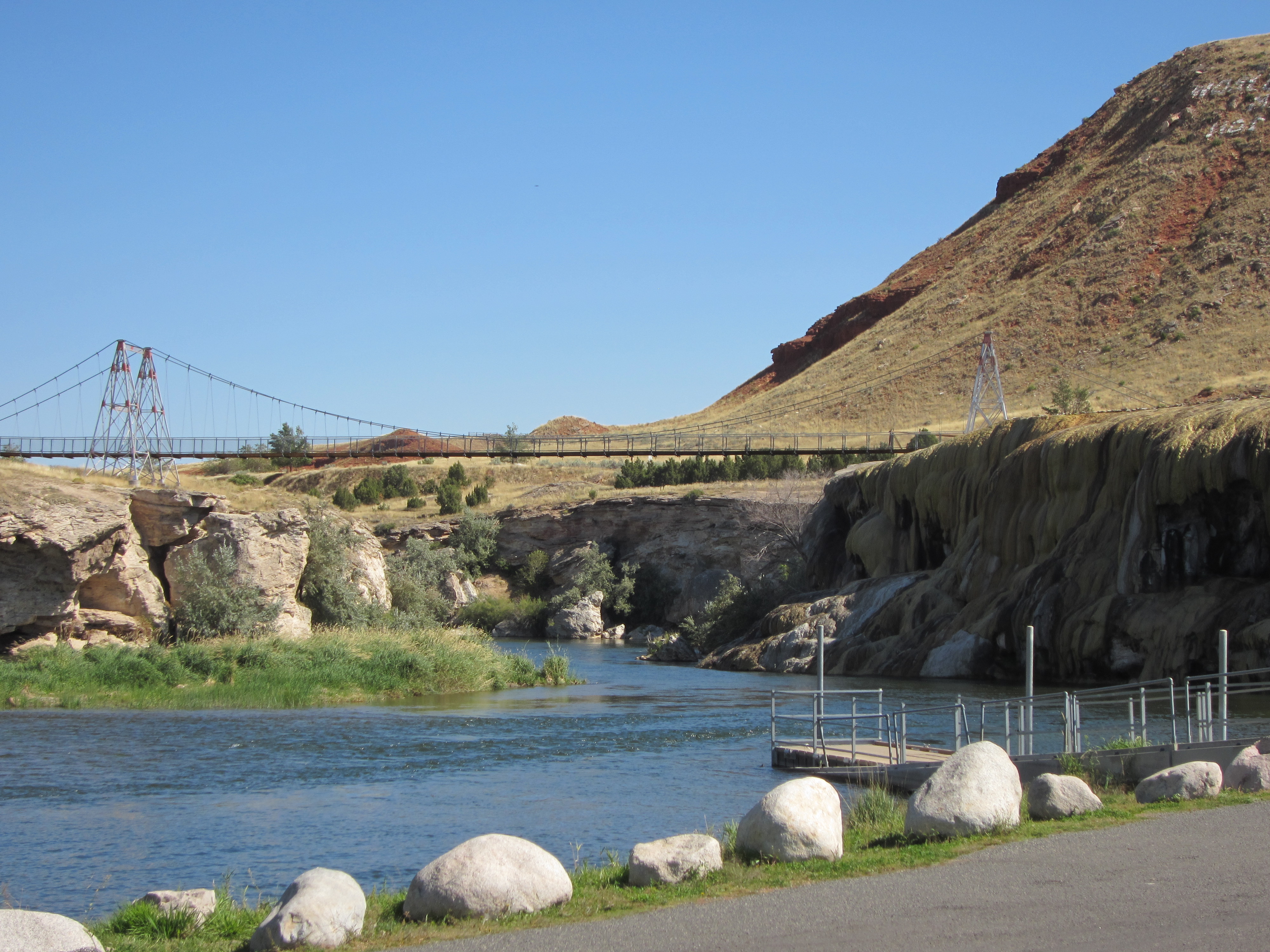
A swinging foot bridge cross the river just north of the hot springs complex. This picture was taken by the boat ramp at the base of the spring looking north with the hot spring terraces on the right.

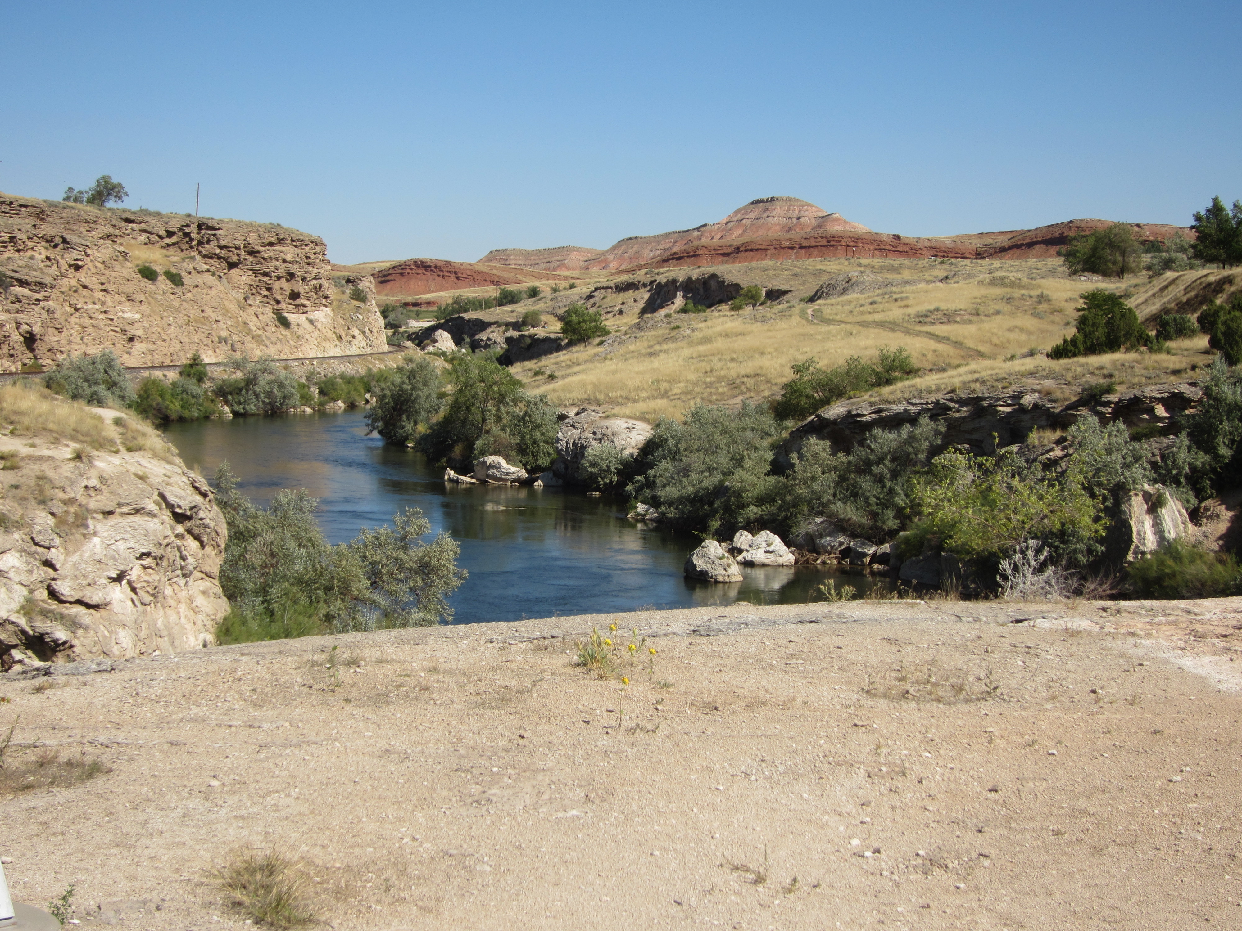
The first picture was taken from the middle of the bridge looking north up the canyon as the river leaves the Thermopolis area; the second was taken from the same spot looking south with the hot springs terraces on the left and the town on the right.


A boardwalk circles the main pool, with views of smaller pools just above the river.

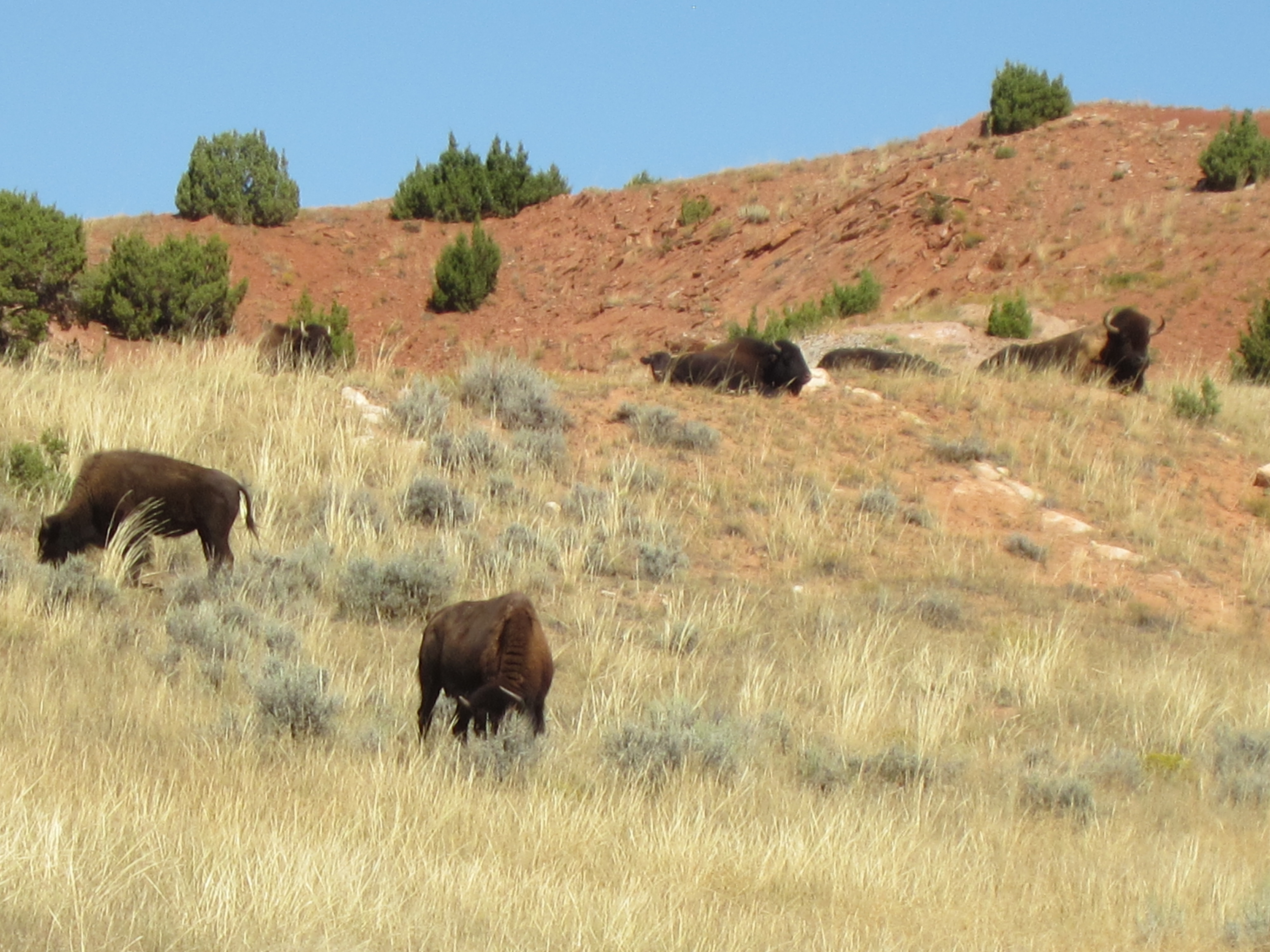
The state park encompasses 10 square miles of land, with the actual hot springs complex located in the southwest corner of the park. Buffalo roam the dry hills in this “mini” Yellowstone Park experience!

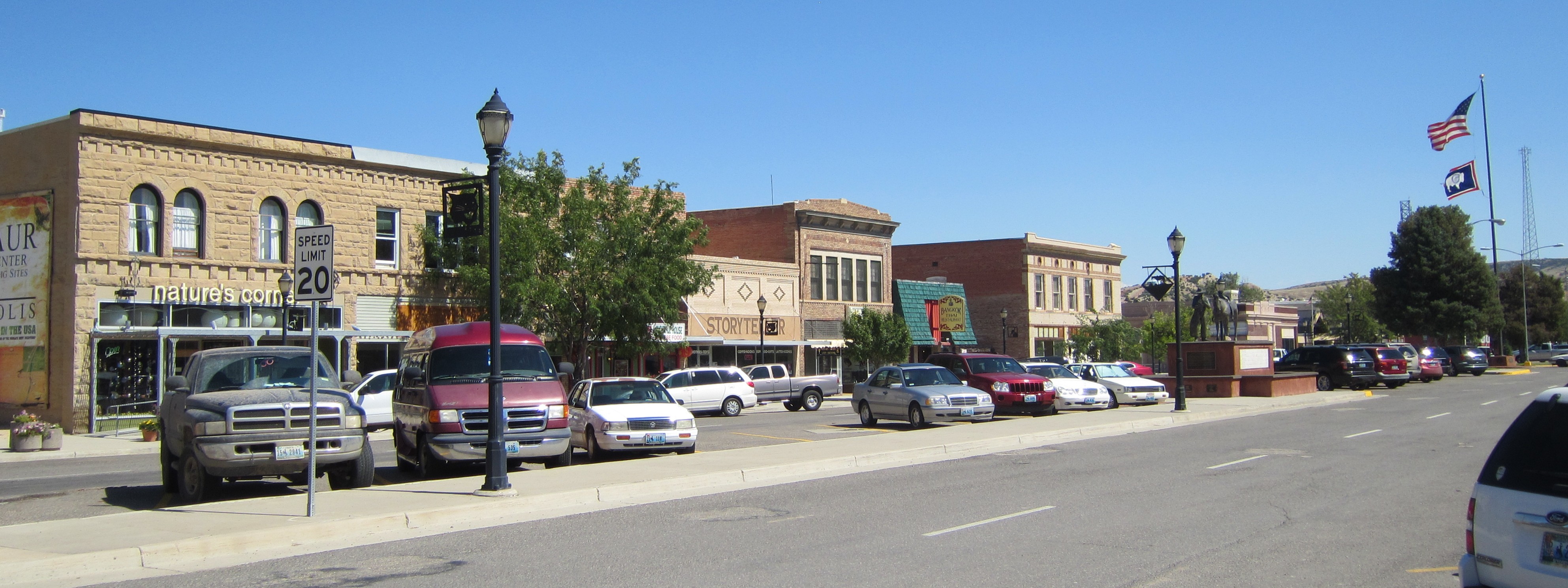
The town of Thermopolis is a bustling little place of about 3,000 people. A small downtown area with restaurants and tourist shops runs for three blocks on Broadway between the highway and the river. A unique feature of the downtown area is that the street is very wide, two lanes in both directions with a parking median in the middle.

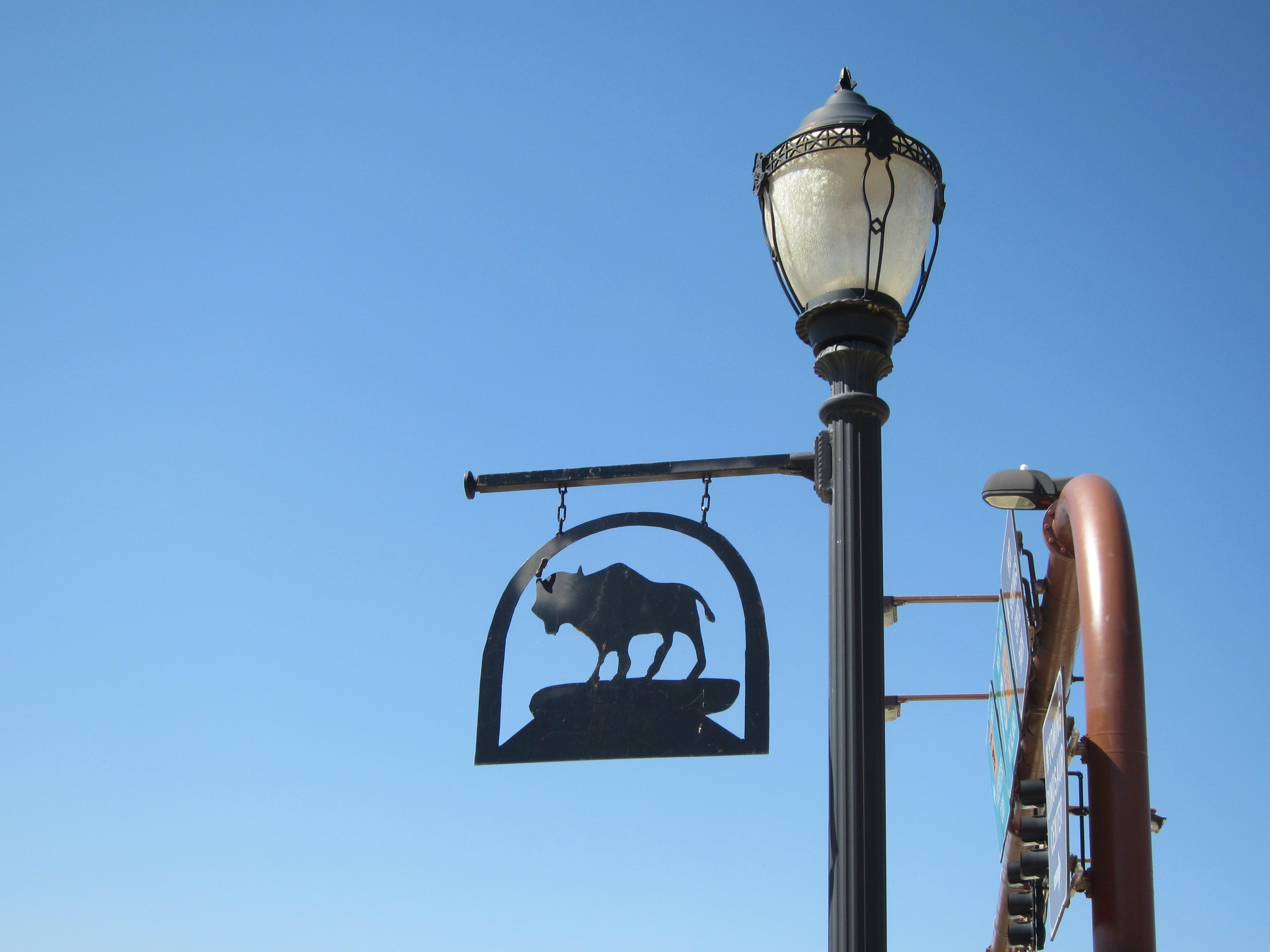
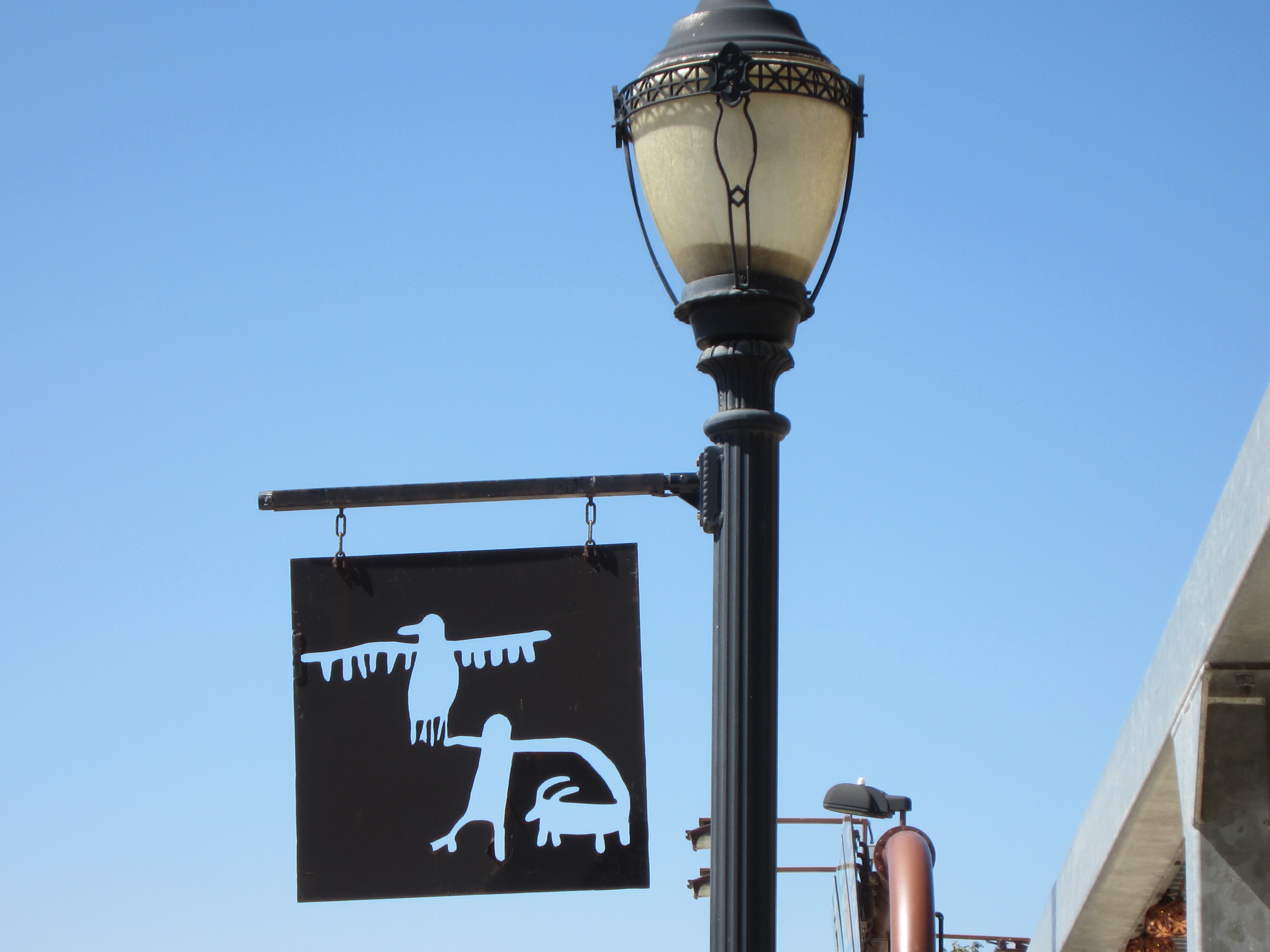
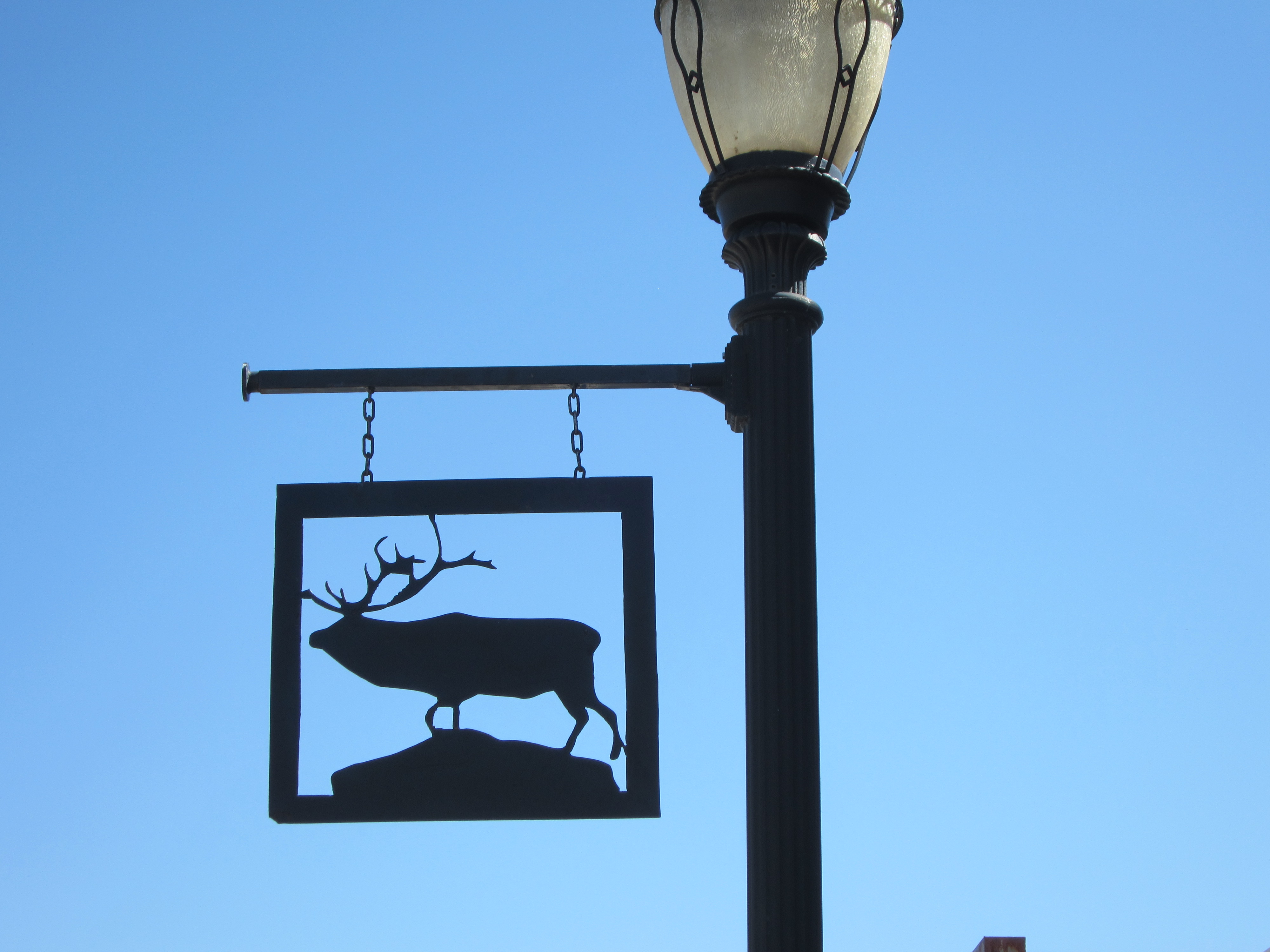
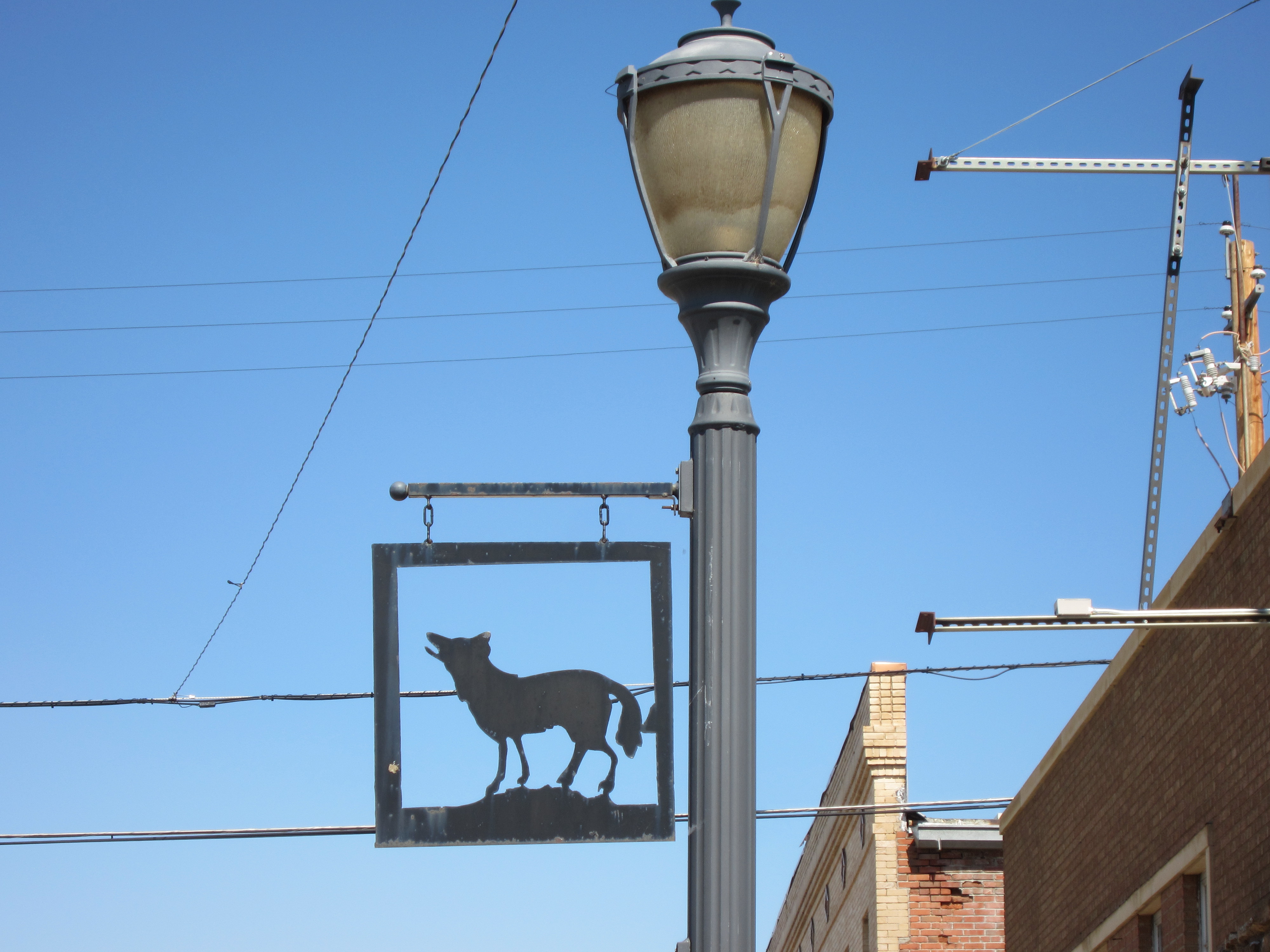
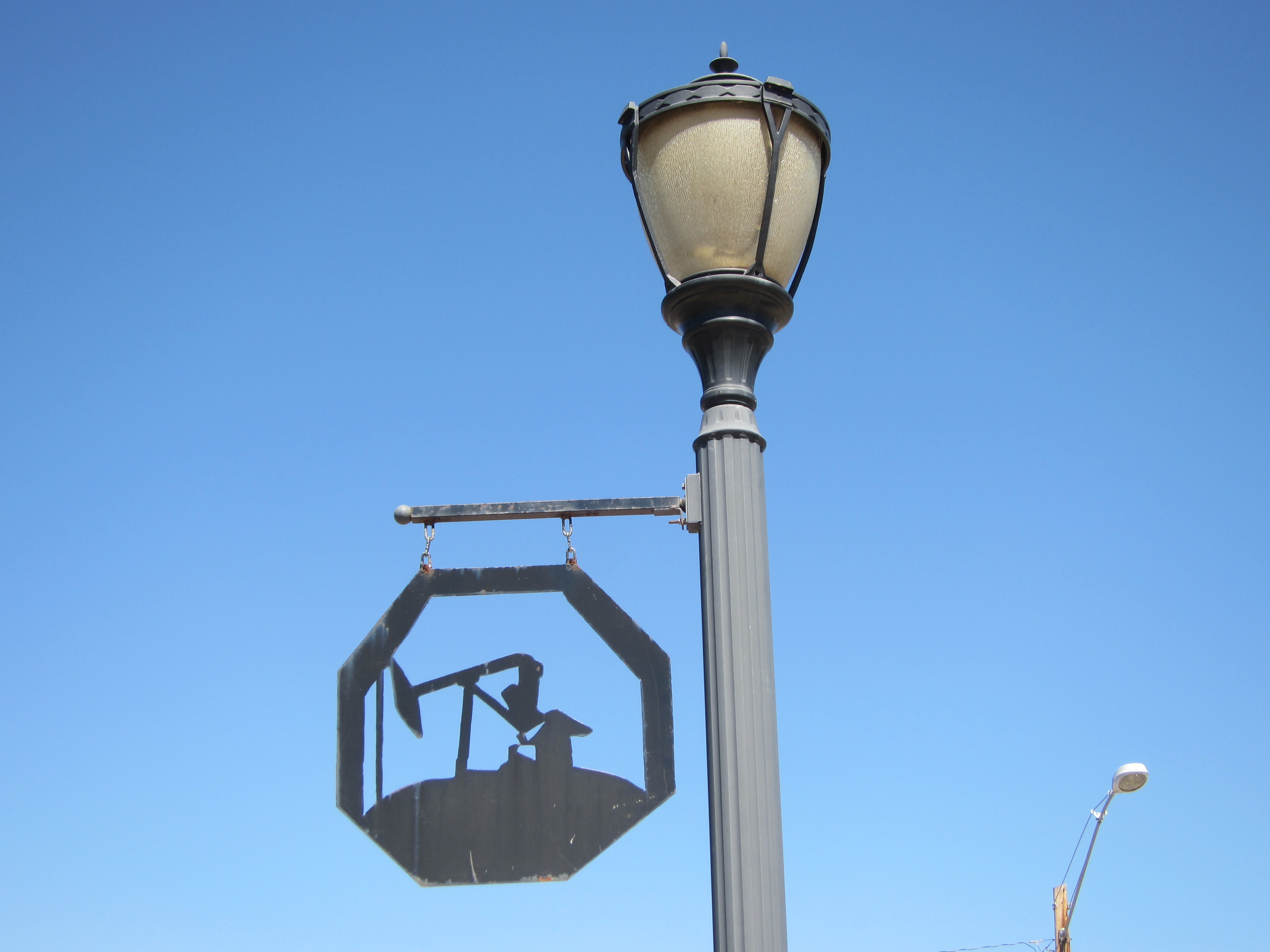
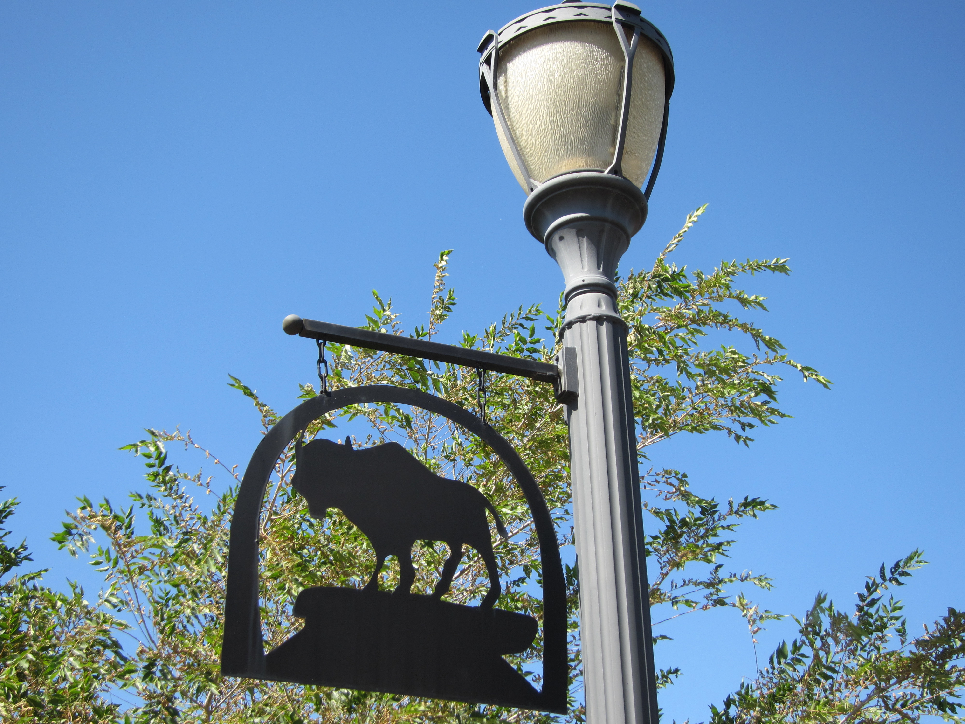
Those who know me know that I am really into metal art and sculpture and Thermopolis provided a pleasant little surprise. Along Broadway and the highway every street lamp is decorated with a hanging metal art piece that carries the western theme. Here’s a selection!


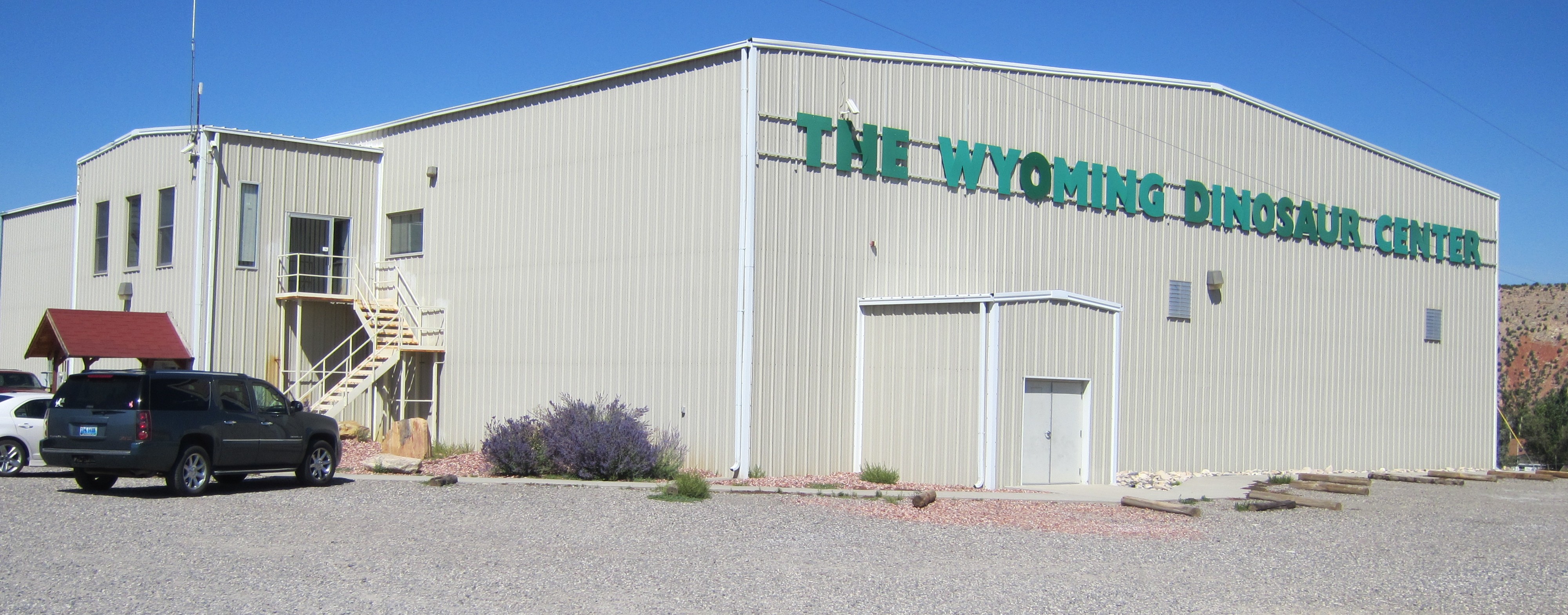
East across the river on a low hill sits a relatively unassuming structure that is widely touted in all of the tourist materials as one of the “must see” attractions of Thermopolis. Sure doesn’t look like much from the outside, does it?

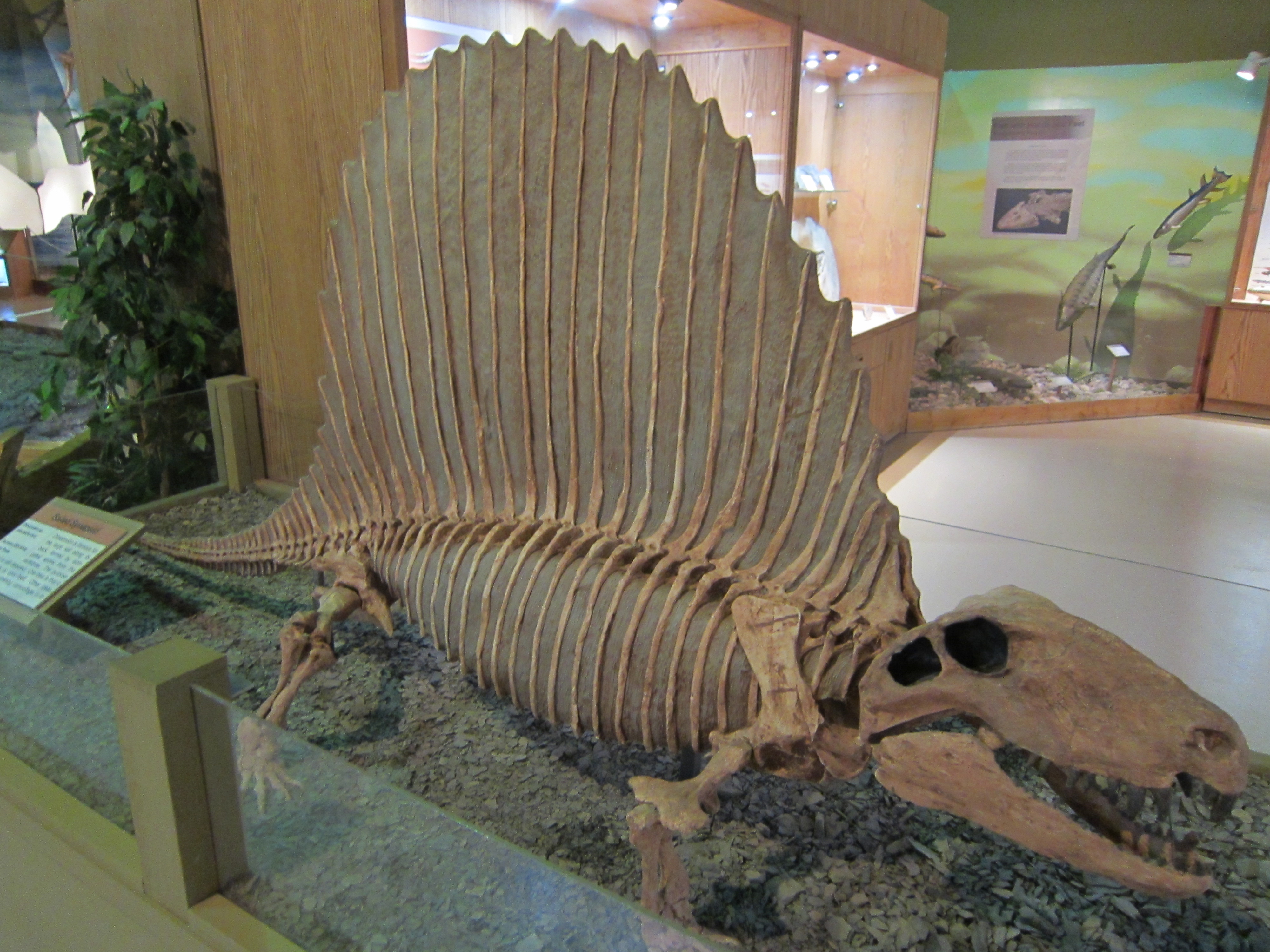
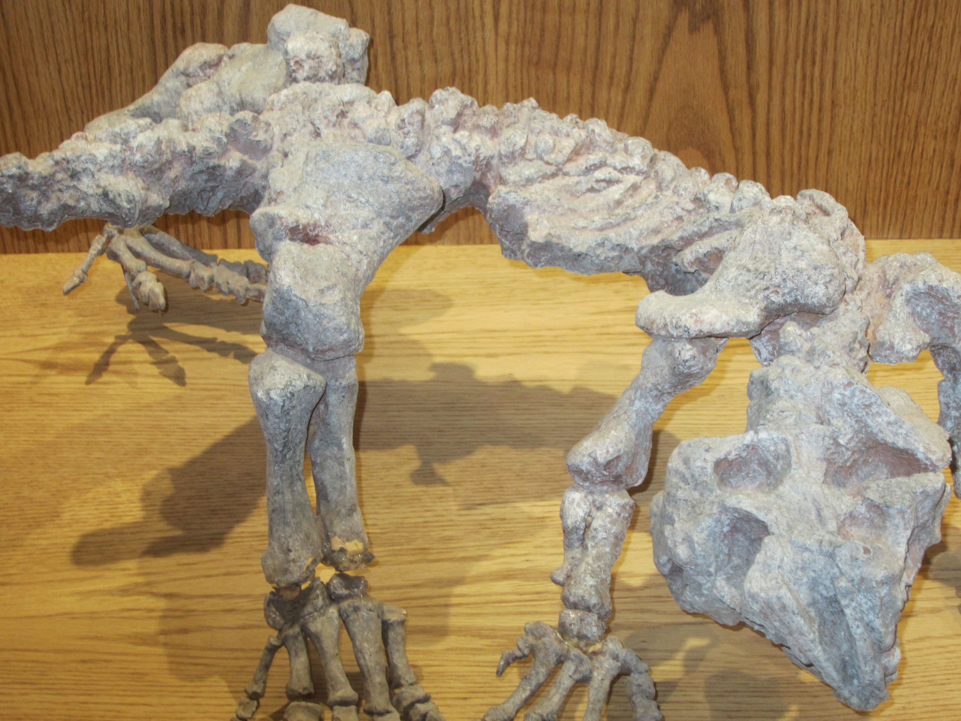
This metal building, sitting up a gravel road in the middle of a large gravel parking lot with minimal landscaping, is the Wyoming Dinosaur Center. Forgive my skepticism as I drove up and momentarily contemplated turning around and getting lunch. But, no, my duty as a blogger called and so I went in. OMG!!!!!! Who knew that this unassuming building would house such treasures? Hopefully the pictures will speak for themselves (the quality of some is not great due to the lighting around the various displays).


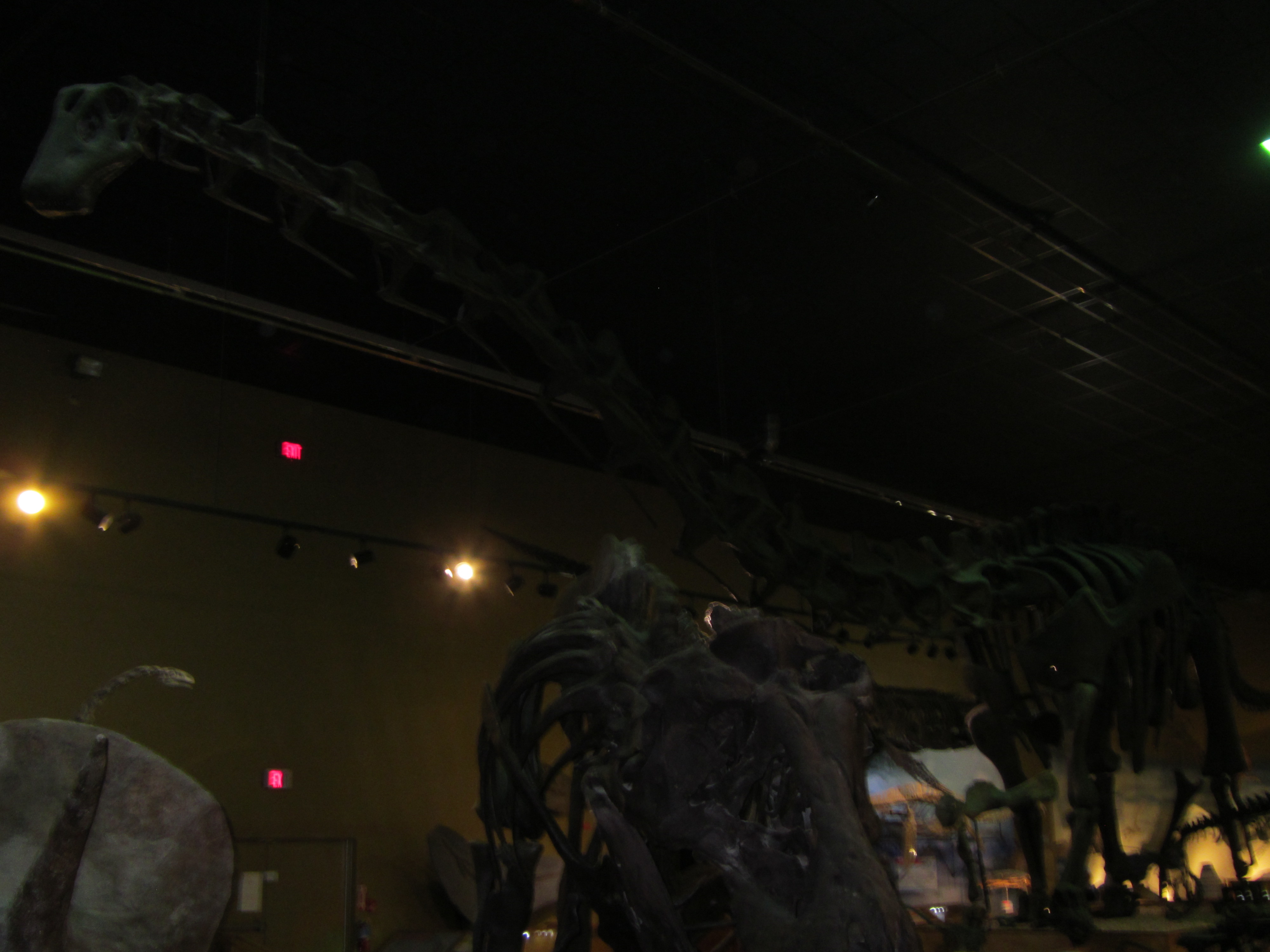
The picture above is hard to see because of the lighting but the head is in the upper left and the body stretches to the bottom right. The long tail is out of the picture. The skeleton is massive, easily reaching close to the ceiling and taking up a third of the floor space. There was also a viewing station where you could look through windows into the laboratory where archeologists were working on specimens. All and all an unexpected bonus to visiting Thermopolis!


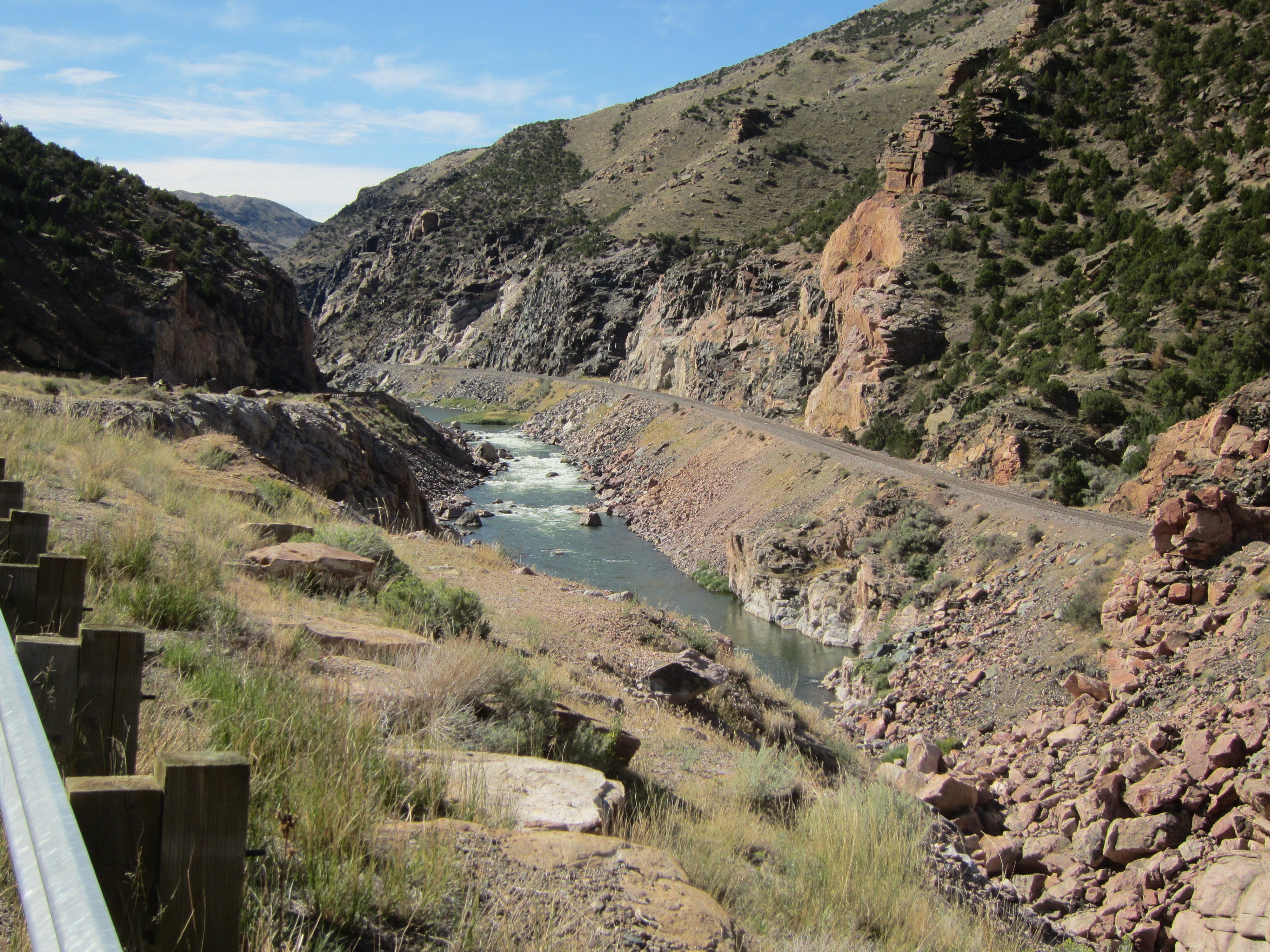
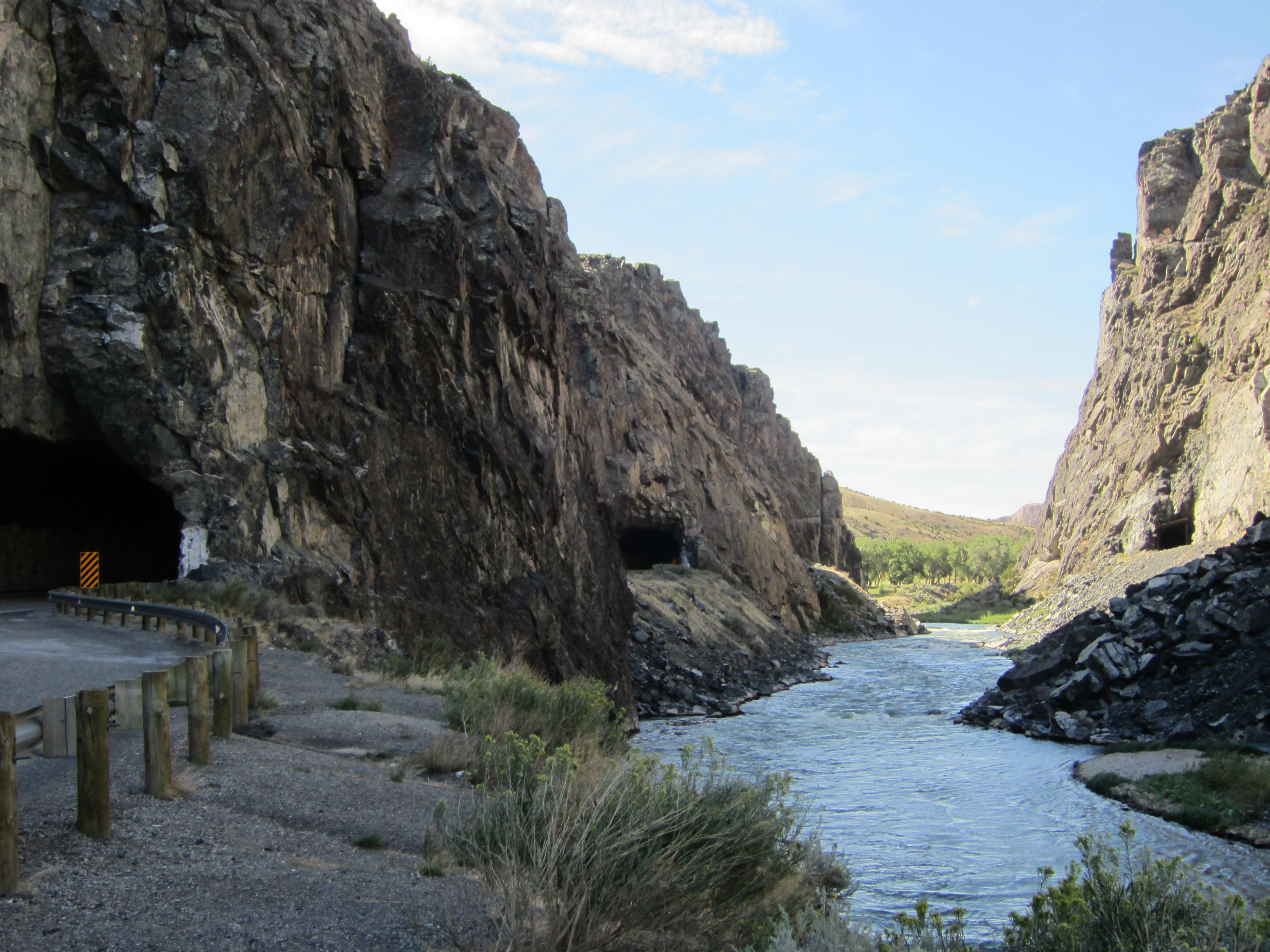
Leaving Thermopolis and heading south on Hwy 20 to Shoshoni, the landscape changes dramatically within 5 miles south of town. Remember that the river is flowing north and we are heading south, so we have been gradually climbing up the valley. In an instant the valley narrows dramatically as we enter the Wind River Canyon, the route the river has cut through the Owl Creek Mountains. For about 10 miles the road, the river, and the railroad are all that can fit into the bottom of the canyon. You’ll note that as we enter the canyon the river changes name. North of the canyon the river is called the Big Horn River, in the canyon and farther south the river is called the Wind River. The first picture is at the entrance to the canyon from the Thermopolis side, the second is at the south entrance of the canyon. The name “Wind River” is aptly bestowed upon the waterway as not only is it cold but the wind is howling through the canyon. I generously unexpectedly leave my cap as tribute to the winds. If you’re ever in the area and find a khaki baseball cap in the bottom of the canyon, mail it to me…


Yes, those are two tunnels in the picture above, large enough that a semi and I passed each other in the second tunnel! After exiting the second tunnel the land opens up again into the arid interior of Wyoming. The river is blocked by a dam just south of the last tunnel and the huge Boysen Reservoir stores the water which gives life to the land at the foothills of the Wind River Range. South of the reservoir the thin green line is the river as it winds across the basin.

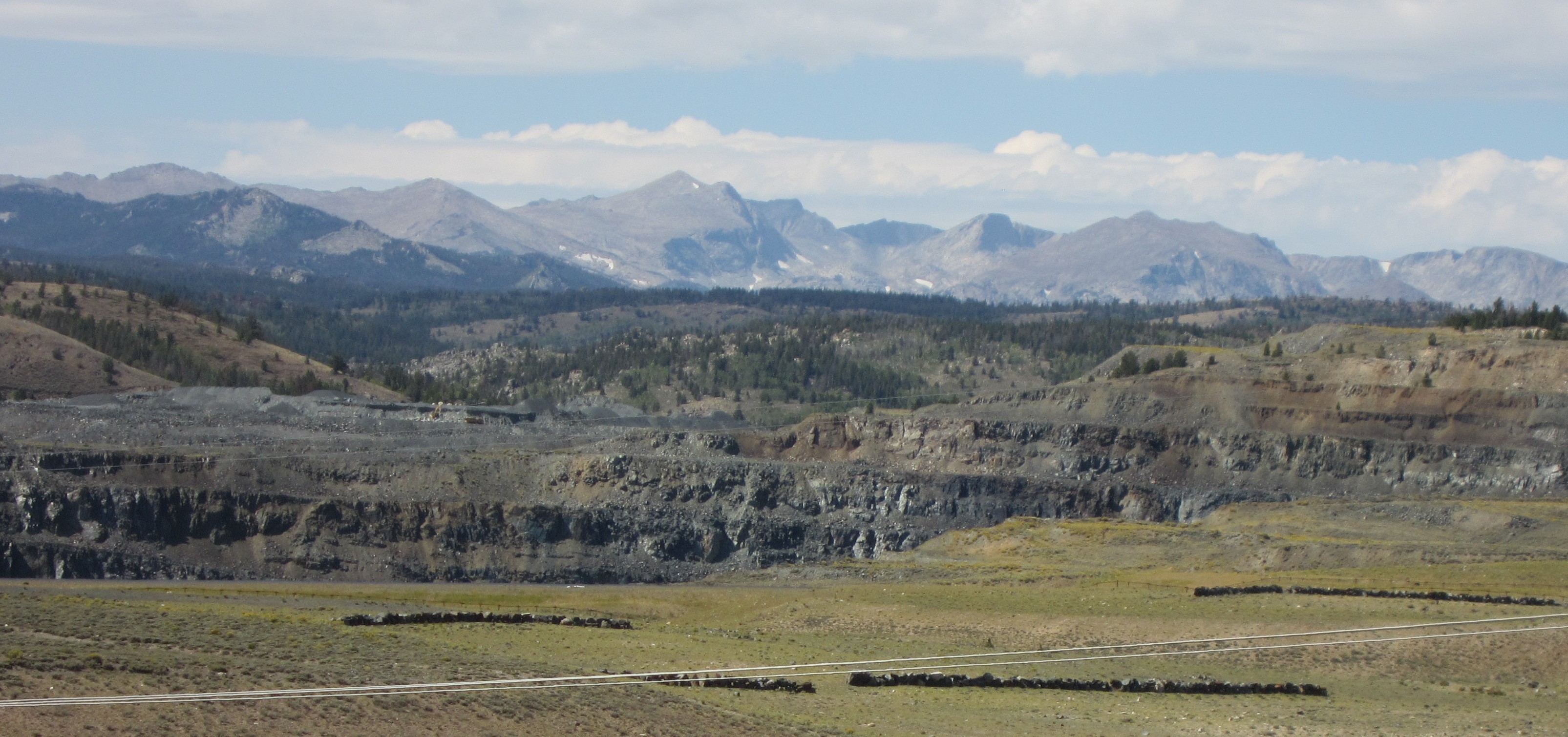
The road now heads southwest towards the base of the majestic Wind River Mountains. The Wind River Range stretches more than 100 miles southeast from Yellowstone National Park has more than 40 peaks reaching more than 13,000 feet to the sky.

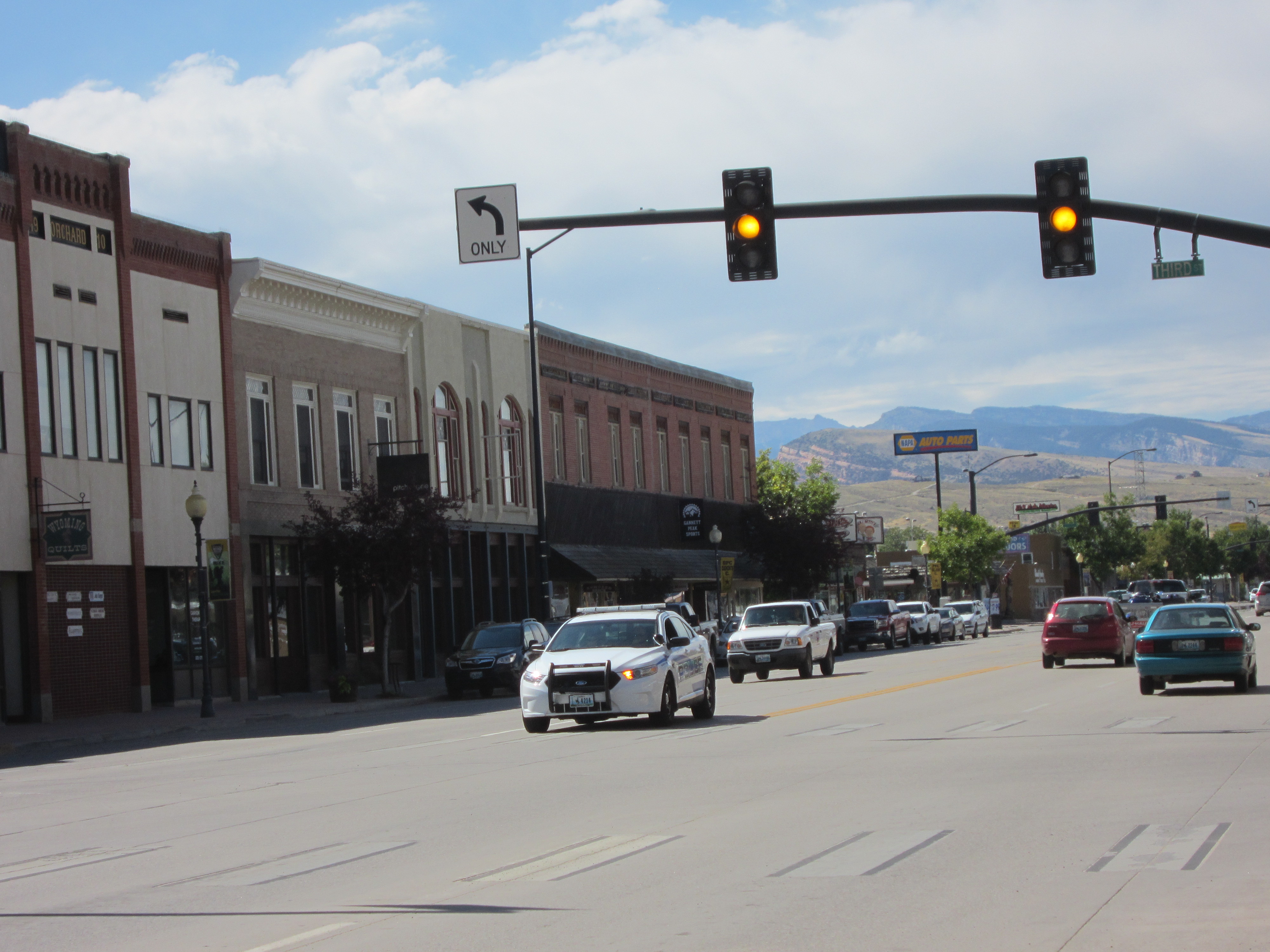
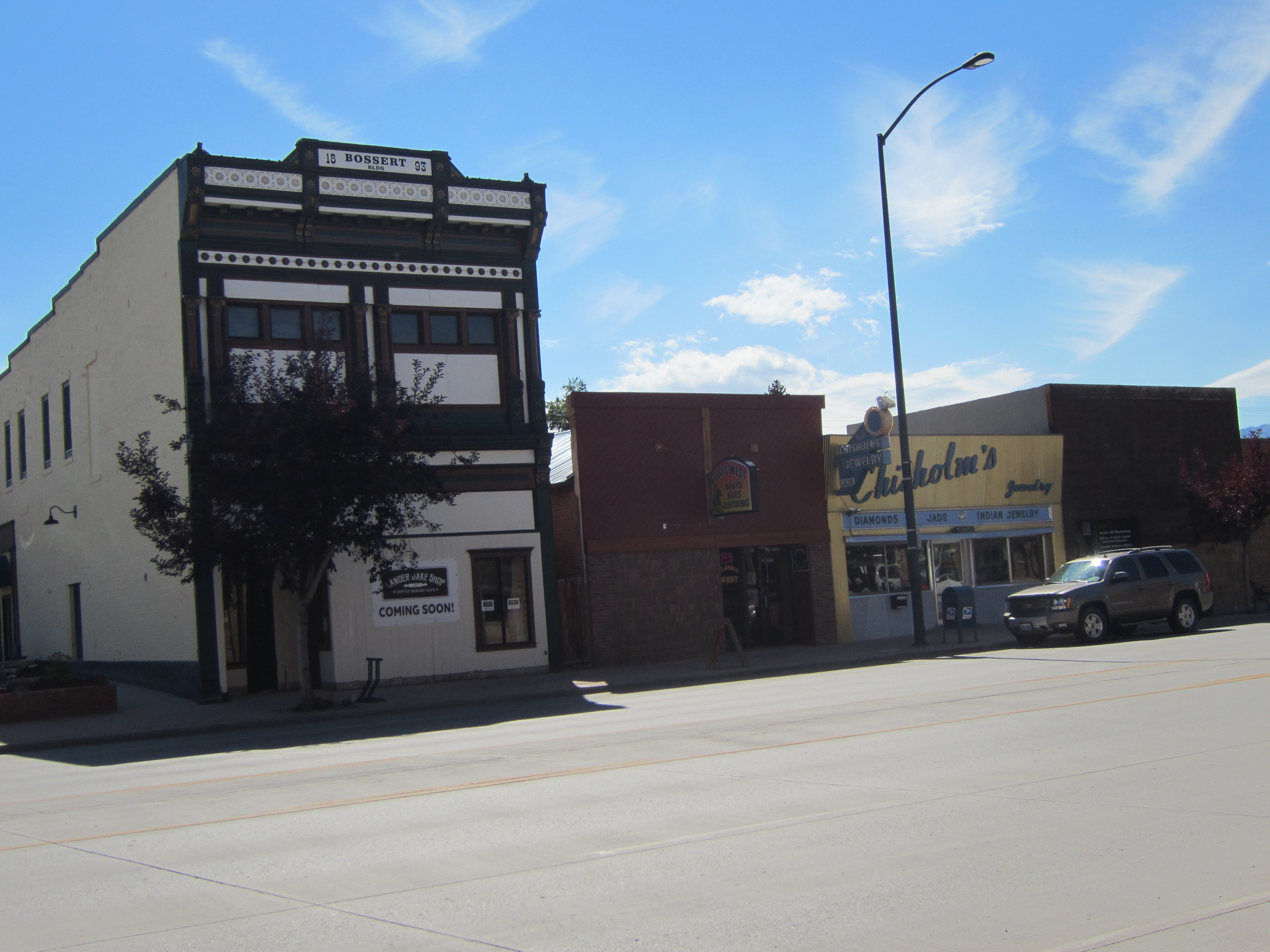
After turning south east on Highway 26 I pass through Riverton, the largest town in central Wyoming with over 11,000 people and the commercial center for the area. A short while later the town of Lander appears, nestled close below the Wind River Mountains. A brief tour of town shows a tidy little place, with a small downtown area full of historical buildings still in use.


Leaving Lander, I turn east on Hwy 287 and head south towards Rawlins. This is truly forgotten land, a high plains desert with virtually no flowing water to be seen, endless landscapes of dirt, gravel, sagebrush and sparse grass in all directions. On maps you will see a large area (roughly 100 miles by 50 miles) that is empty and simply labeled “The Great Divide Basin”. The land has so little change in elevation that the Continental Divide actually splits and encircles this space, meaning that the little moisture that falls here as rain or snow is absorbed by the ground or sits on flat spots and evaporates rather than flowing to either the Atlantic or Pacific Oceans, leaving soil that is incredibly inhospitable to vegetation. While not entirely flat, there are immense stretches that seem so; ringed by mountains of bare stone rising in the distance. This photo was taken about 10 miles north of Rawlins, looking back to the northwest.

Central Wyoming is the scene of brutal winter weather with raging blizzards of wind and snow frequently occurring in below zero temperatures. The wind whips the snow into huge drifts, often making roads impassable. The highway is lined for miles and miles on the west side with long stretches of snow fence, designed to help prevent drifts from blocking the road.


Another indication at how treacherous this land is can be seen at every major highway intersection between Thermopolis and Rawlins. There are large signs decorated with blinking lights in place to warn motorists that the road ahead is closed and they need to turn back to the nearest civilization. This is because the weather conditions can be so extreme in the winter that the roads close, including the interstate across southern Wyoming due to blowing snow and the resulting lack of visibility. While the quantity of snow may not be great, the never-ending wind blows it into huge drifts that close the highways, including the interstate. Ignoring these warnings can result in dire consequences…
The high desert landscape continues as we head south of the interstate towards Colorado, often punctuated with the infrastructure created for the local oil and gas industry.

Once over the state line the foothills of the Rocky Mountains rise to the east.

The approach to the Yampa River Valley, a tributary of the mighty Colorado River, weaves through a land that reflects recent rains as the vegetation has temporarily turned green and flowers are in bloom. The illusion is fleeting as this area is deep in the grips of one of the worst droughts in modern memory.

We meet the Yampa River in the town of Craig, which sits near the northeast edge of the massive Colorado Plateau. The Colorado Plateau is the name given to the huge area that lies between the Rocky Mountains to the east and Wasatch Mountains to the west the is drained by the Colorado River and its tributaries. This high desert region, occasionally punctuated by small mountain ranges, was home to the ancient people known as the Anasazi.

The northwestern region of the Colorado Plateau is known as the Western Slope, and the commercial center of the region is the town of Grand Junction.
Next Up: The Western Slope
Post a Comment